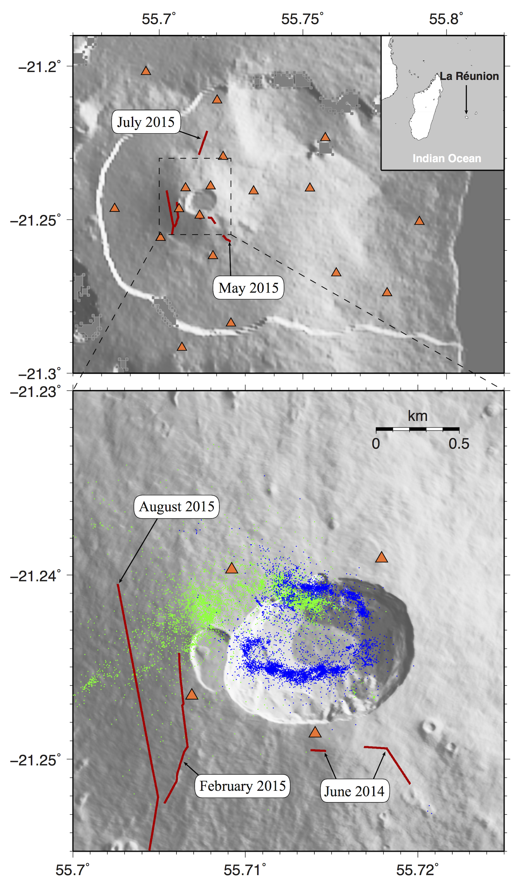
Piton de la Fournaise volcano - (top) Global map of the Piton de la Fournaise volcanic edifice. Orange triangles indicate seismic stations used in this study. Code names are indicated for stations used for event detection. The eruptive fissures of the five studied eruptions are indicated by red lines. (bottom) Same as the top subfigure with the location of all relocated shallow earthquakes (blue dots) and deep events (green dots) in 2014 and 2015 |